Saving the Shipwrecks of Stellwagen Bank
Remotely operated vehicle Pixel examines a shipwreck. Photo courtesy of Marine Imaging Technologies/NOAA.
Shipwrecks captivate our imagination, and are the subject of many books, academic papers, and movies—from the world-famous Titanic, to sunken World War II warships, to ancient fishing canoes. Some describe them as time capsules of our maritime history, waiting to be discovered and opened.
But there’s a group of people who are drawn to shipwrecks for very different reasons, and it sometimes leads to the demise of the wrecks themselves: fishermen.
In this episode, why archaeologists and fishermen have sometimes been at odds over shipwrecks, and the federal government program that’s bringing them together under one common cause.
Featuring Ben Roberts, Mike Bailey, Tom Hill, Calvin Mires, and Ben Haskell.


ADDITIONAL MATERIALS
The loss of the Pentagoet rated a page 2 story; the tragedy of the Portland sinking took the front page. Image: Boston Daily Globe, 12-2-1898
Learn more about the many known shipwrecks of Stellwagen Bank, including the Portland, known as “New England’s Titanic.”
Check out some of the other research projects at Stellwagen Bank on topics as varied as whales, sand lances, and seabirds.
SUPPORT
To share your questions and feedback with Outside/In, call the show’s hotline and leave us a voicemail. The number is 1-844-GO-OTTER. No question is too serious or too silly.
Outside/In is made possible with listener support. Click here to become a sustaining member of Outside/In.
Follow Outside/In on Instagram or join our private discussion group on Facebook.
CREDITS
Host: Nate Hegyi
Reported, produced, and mixed by Felix Poon.
Editing by Katie Colaneri and Taylor Quimby.
Our staff includes Justine Paradis, Marina Henke, and Jessica Hunt.
Executive producer: Taylor Quimby
Rebecca Lavoie is NHPR’s Director of On-Demand Audio
Music by Blue Dot Sessions, Walt Adams, Cora Zea, and Helmut Schenker.
Outside/In is a production of New Hampshire Public Radio.
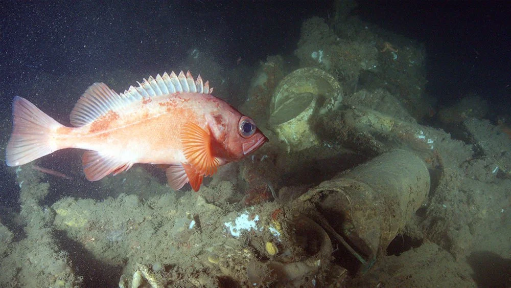
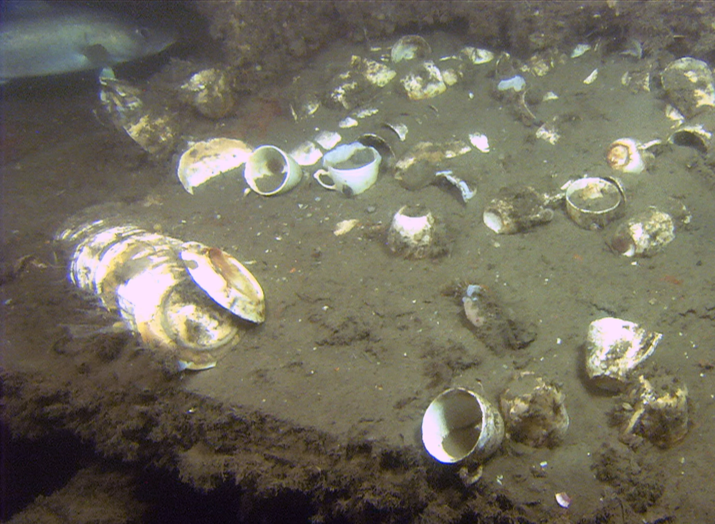
A redfish swims over cups, bowls, and other items that may have been in Portland’s galley. Photo courtesy of WHOI/NOAA
Audio Transcript
Note: Episodes of Outside/In are made as pieces of audio, and some context and nuance may be lost on the page. Transcripts are generated using a combination of speech recognition software and human transcribers, and may contain errors.
Nate Hegyi: Hey, this is Outside/In, a show where curiosity and the natural world collide. I’m Nate Hegyi.
[Seagulls on the dock ambi]
Nate Hegyi: Earlier this summer, a couple of researchers gathered on a commercial dock in Gloucester, Massachusetts. Their names are Mike Bailey, and Ben Roberts. Producer Felix Poon was there, too.
Felix Poon: So what you got in the back of your truck here?
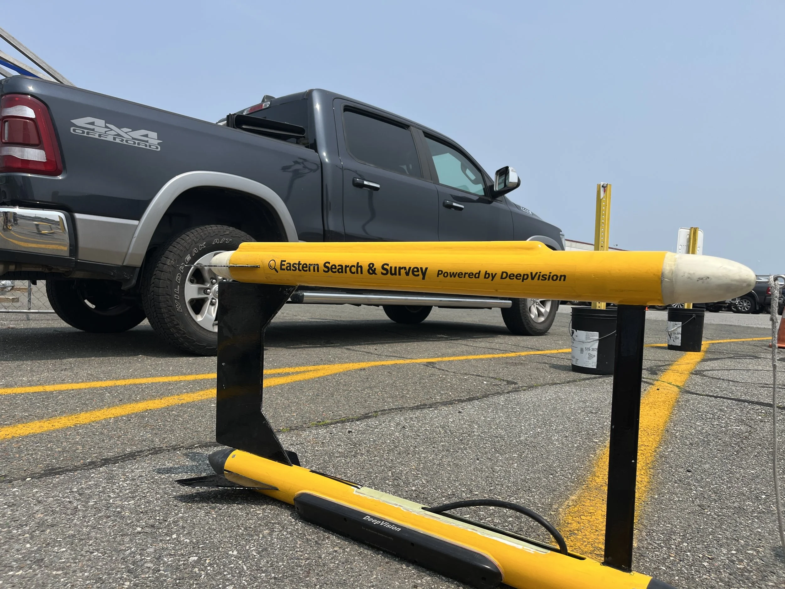
Ben Roberts: All the gear. we've got the, uh… heave compensator, winches, uh, depressor tow fish, um, cables, monitors, laptop. You know, all that, all the good stuff.
Nate Hegyi: All this fancy science gear got the attention of a fisherman walking by on the dock with his kid.
Fisherman: [distant] Charlie look at this! Look Charlie, torpedoes.
Kid: [inaudible]
Fisherman: yeah they’re torpedoes
Mike Bailey: It's an underwater camera.
Fisherman: These guys are pirates.
Mike Bailey: Basically.
Fisherman: You're going out with Tom?
Mike Bailey: Yeah we are. So we're going to be going out looking for some shipwrecks.
Fisherman: Oh, nice. Any in particular?
Mike Bailey: We're not sure. The ones we're going after are not marked or known.
Fisherman: Okay.
Mike Bailey: So they're all total mystery, which is kind of amazing.
Fisherman: Gold? Loot?
[MUX IN: Dialtone 11 - Blue Dot Sessions]
[00:58:56-00:59:00] Mike Bailey: No idea. Possibly. Hopefully. Something cool.
Nate Hegyi: Mike and Ben are looking for shipwrecks, but they’re not pirates in search of gold and treasures. They’re working for NOAA, the National Oceanic and Atmospheric Administration.
There are an estimated 200 shipwrecks just sitting there at the bottom of the sea floor in an area stretching off the coast of Gloucester down to Provincetown in Cape Cod.
Fisherman and his son: All right, well, good luck out there.
Nate Hegyi: To find them, they’ll need the help of a fisherman… Captain Tom Hill.
Felix Poon: Hi. Nice to meet you, Tom. I'm Felix.
Tom Hill: Pleased to meet you. Felix.
Do you guys eat lunch yet? Belly growling?
Felix Poon: No, I ate something. Yeah.
Nate Hegyi: Today the plan is to set up their equipment on Tom’s boat. And then for the next nine days, Tom, Mike, and Ben will be going out on the water to scan the sea floor for ship wrecks.
[MUX OUT]
Tom Hill: Are you going to come out with us?
Felix Poon: Well, I'm going to pick one day, probably early to mid next week.
Tom Hill: Okay. Yeah. Bring a nice big lunch. Roast beef sandwiches, all the bells and whistles. So if you get sick, we can eat your lunch for you.
[MUX IN: Awake Until Noon - Walt Adams]
Yeah. Don't bring a peanut butter and jelly sandwich. Bring prime rib and all that.
No, you won't get sick.
<<NUTGRAPH>>
Nate Hegyi: Archaeologists say that ship wrecks are keys to our cultural heritage: underwater sites of maritime history that must be protected.
Ben Haskell: Out there… strewn across the ocean… are these time capsules that are waiting to be discovered and waiting to be opened
Nate Hegyi: But there’s another group of people who care a lot about ship wrecks too, but for very different reasons.
Tom Hill: The wrecks always seem to hold a pile of fish. But you can't get your net into the wreck, or else you're going to lose the whole kit and caboodle.
Nate Hegyi: In this episode of Outside/In: We go behind the scenes on a federal project that’s trying to help fishermen and archaeologists preserve the past… and their livelihoods.
Producer Felix Poon has the story. Stay tuned.
<<PRE-ROLL BREAK>>
Felix Poon: This is Outside/In, a show where curiosity and the natural world collide. I’m Felix Poon.
The effort to map the seafloor and look for ship wrecks off the coast of Massachusetts is a program run by the Stellwagen Bank National Marine Sanctuary.
You’d be forgiven for never hearing about national marine sanctuaries. Everyone knows about national PARKS – Yosemite and Yellowstone. But who’s ever heard of Flower Garden Banks off the coast of Texas? Or Stellwagen Bank, for that matter?
Congress created these marine sanctuaries to keep oil and gas drilling out, and to preserve them for fishing, diving, whale watching…
And these marine sanctuaries are also good spots for archaeological research, like the Stellwagen mapping initiative that I’m tagging along on. Here’s Mike Bailey.
Mike Bailey: the origin of the country…ties back to fishing, in this area, and the job has always been very kind of hazardous. And, and when those ships, unfortunately, when they sink and when they, you know, go to the bottom of the ocean, they're often preserved fairly well. And so it becomes kind of like a time capsule.
Felix Poon: The most storied ship wreck in these parts? Is the Portland.
[MUX IN: A Pulse of Rain - Blue Dot Sessions]
Calvin Myers: a really luxurious steam passenger ship almost the length of a football field.
Felix Poon: This is Calvin Myers, a maritime archaeologist. The Portland was a majestic 19th century steamship, with gold trim and luxurious velvet carpets. It was one of New England’s largest vessels in the 1890s, regularly ferrying hundreds of passengers between Boston and Portland, Maine.
Ben Haskell: a lot of the crew were African-American.
Felix Poon: And this is Ben Haskell, the long time deputy superintendent of Stellwagen Bank until he retired last year.
Ben Haskell: African Americans found good paying jobs on, on ships, um…. How far they could rise in the ranks on the ship itself were limited for African Americans. But nevertheless, you know, the jobs were relatively well paying.
[MUX SWELL AND OUT]
Felix Poon: Then in 1898…
Calvin Myers: It was heading from Boston to Portland overnight, just a few days after Thanksgiving. And so a lot of people were returning home after seeing their family after holidays and…
Calvin Myers: one of the original perfect storms that New England's kind of famous for two storms collided and overwhelmed, this passenger ship
[MUX IN: Vulcan Street - Blue Dot Sessions]
Felix Poon: Winds gusted up to 70 miles per hour. Waves were as high as 30 feet, and engulfed the hull, flooding its compartments. The Portland went under.
All of its passengers and crew died, nearly 200 people. These days, it’s known as “The Titanic of New England.”
[MUX SWELL AND OUT]
For nearly a century, no one knew exactly where The Portland sank. Though several attempts had been made to find it (including one funded by the Boston Globe newspaper that involved dragging a cable between two boats along the sea floor.)
But every attempt turned up empty.
Until the late 1970s… That’s when a team led by a man named John Fish and his underwater archaeology company spent years on their own dime looking for the Portland.
It was a sophisticated operation. They plotted where the boat could have been when it sank. One way they figured this out was by using the average time of the stopped watches worn by the recovered bodies: 9:15, though it wasn’t clear if it was 9:15 AM, or PM.
They used what’s called side-scan sonar and eventually found a wreck that looked like it could be The Portland, in 1989. But the photos they got were too low resolution to say for sure.
The search was stuck.
Then, more than a decade later, Ben Haskell came back to the site with the latest in side-scan sonar technology, and an ROV – a remotely operated vehicle outfitted with a live camera
[MUX IN: Meanwhile, Below - Blue Dot Sessions].
Sure enough, it was The Portland.
Ben Haskell: the Portland is just a, um, an absolutely stunning shipwreck on the sea floor because it it's upright, and the entire hull is still intact on the sea floor, And it's just a beautiful, beautiful sight.
Felix Poon: Archaeologist Calvin Myres operated the ROV on a later expedition to the Portland. He saw broken timbers and objects strewn about. But what haunted him was what wasn’t broken.
Calvin Myers: you see the plates and cups perfectly, basically stacked as if you know were put away after their final meals. And it's that small, intimate where like, oh, I could have had that cup of coffee I could have had, you know, that would have been my plate, that somebody would have cleaned up. Like, okay, this isn't a shipwreck. It's actually a vessel where people were and were living and having a good time up until they weren't. And the juxtapositions, again with the dinnerware and the complete chaos and darkness of doom and death below it. Uh, it's it hits you right in the face.
[MUX SWELL]
Felix Poon: To preserve shipwrecks like the Portland, that’s why the Stellwagen Marine Sanctuary is mapping the seafloor.
Remember, there are an estimated 200 shipwrecks on the bottom of Stellwagen Bank. But even the marine sanctuary doesn’t know where they all are. So the first step is to find them.
Ben Haskell: Out there in the ocean. Strewn across the ocean are these little time capsules that are waiting to be discovered and waiting to be opened.
And it's really important to continue that exploration to find those time capsules, because we never know, you know, what we're going to learn about where we came from and how we got here.
[MUX SWELL AND OUT]
Tom Hill: All right, so I got my drill. I got my flashlight. All right. My good luck charm.
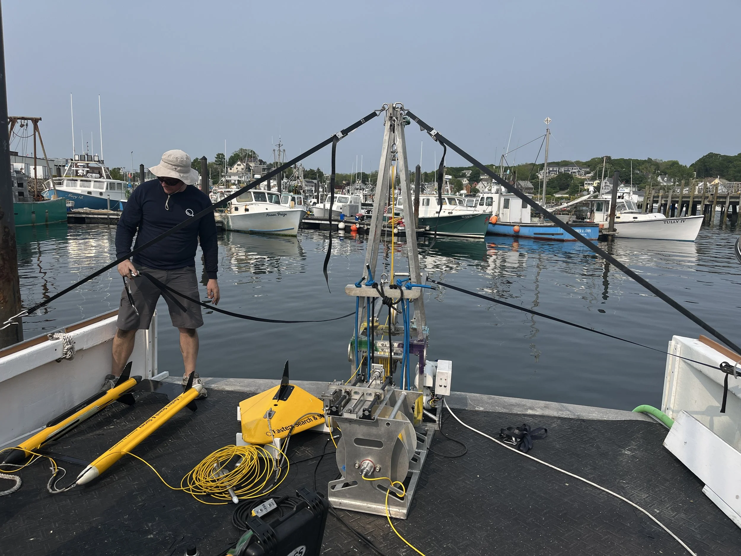
Felix Poon: I’m on the boat with Captain Tom Hill and researchers Mike Bailey and Ben Roberts.
They’re setting up what looks like a miniature crane on the back of Captain Tom’s boat.
Ben Roberts: You can't beat a captain who's willing to put holes in his boat to install your equipment.
Mike Bailey: Talk about accommodating.
Felix Poon: This crane will be pulling what’s called a tow fish behind the boat. The tow fish looks like two yellow torpedoes attached together. It’s what maps the seafloor.
It’s a bit tedious to set up. Mike, Ben, and Tom work together for a few hours to make sure it’s done just right.
Tom even gets into this crawl space through this big hatch that’s smack dab in the middle of the deck.
Tom Hill: Hey, Felix, you got a pinky swear? If I leave that hatch up, you won't fall in it, right?
Felix Poon: I pinky swear.
[01:58:36-01:58:48] Tom Hill: Sometimes people walking around looking like, uh oh. Damn. Even for me, I gotta happen before. No, no, I'm very fortunate. But if it does happen, you get seriously hurt.
Felix Poon: Once they’ve got everything hooked up, all the wires and all the cables, Ben tests everything to make sure it’s all working.
Ben Roberts: I fired up the towfish. Looks good. All the connections inside are good. Beautiful. Um, winch seems to work
Ben Roberts: I think that's it. I think we're ready to rock.
Mike Bailey: Beautiful.
[MUX IN: Sumire - Blue Dot Sessions]
Felix Poon: They wrap it up for the day, and talk through their plans for the week.
Ben Roberts: one of those days might be good to go look for that, miss Sandy, because that's like a real short run.
I pick a day to tag along.
Mike Bailey: Something exciting. We want to, you know, give them a nice target that we're going to go look for and hopefully have something to to show.
[MUX SWELL]
Felix Poon: After a break, we see what we find on the sea floor.
[MUX SWELL AND OUT]
<<MIDROLL>>
Felix Poon: Welcome back to Outside/In, a show where curiosity and the natural world collide. I’m Felix Poon.
Before the break, I was with a couple of researchers and a fisherman about to look for ship wrecks on the sea floor of the Stellwagen Bank National Marine Sanctuary, just off the coast of Massachusetts.
But before we take that trip, I’m gonna tell you where the idea to map the sea floor came from in the first place. So let’s go back to a day in early spring 2017.
[MUX IN: Clay Pawn Shop - Blue Dot Sessions]
Ben Haskell was the deputy superintendent of Stellwagen Marine Sanctuary at the time. And he was checking a website called MarineTraffic.com. It’s like a Google Maps for the oceans. But instead of one little arrow showing where your boat is, it’s hundreds of thousands of arrows showing where all the boats in all the oceans, lakes and rivers on the planet are, moving around in real time.
And on that day Ben noticed something. He zoomed in, on a little corner of the marine sanctuary, and saw lots of boats…about 70 of them…bunched together, going back and forth. Back and forth.
Ben Haskell: what I saw shocked me. And it turned out to be scallop fishing, on top of Stellwagen Bank
Felix Poon: The fishing itself wasn’t what Ben was worried about. Fishing is perfectly legal in most marine sanctuaries. Ben was concerned about the dredges these boats drag across the sea floor. They’re massive steel nets weighing as much as 3,000 pounds. They catch you lots of scallops, but they can also destroy anything in their path.
Ben Haskell: We were very concerned about the possible impacts on shipwrecks and particularly historic shipwrecks, which we knew there were several of in that area.
Felix Poon: Ben went out to assess the damage later that summer.
Ben Haskell: I was kind of hoping that they somehow missed the wrecks we were concerned about.
Felix Poon: But, no such luck. There was this one shipwreck, the North Star, that was popular with scuba divers because of all the colorful sea creatures living on it, and it was decimated. Its remains got dragged off in all directions.
Up to this point, the marine sanctuary’s policy to protect ship wrecks was to keep the coordinates for the ones they knew about secret, because they didn’t want anyone looting artifacts.
But clearly that did nothing to protect the North Star. Ben thought they needed a different approach.
He thought maybe, instead of keeping their locations secret, they’d do the opposite. They would tell fishermen exactly where the shipwrecks were. Try to encourage them to stay away, or go around them.
And…by the way, we’re saying fishermen because generally, that’s the term both men and women who fish prefer.
Anyway, as of this moment…the marine sanctuary only knows where 47 of its estimated 200 shipwrecks are. So if they’re going to protect all the wrecks, they have to find them first. That’s where the Stellwagen mapping initiative comes in.
[MUX SWELL AND OUT]
Mike Bailey: Good morning. How are you doing?
Felix Poon: Good. How are you?
Mike Bailey: Good, good. Nice. Chilly, breezy. Morning today… so it might be a little rougher than we've had for a couple days.
Felix Poon: Okay, perfect. Yeah. Just what the doctor ordered. That's right, that's right. Yeah. Okay
Felix Poon: That’s Mike Bailey, project manager with the Stellwagen National Marine Sanctuary.
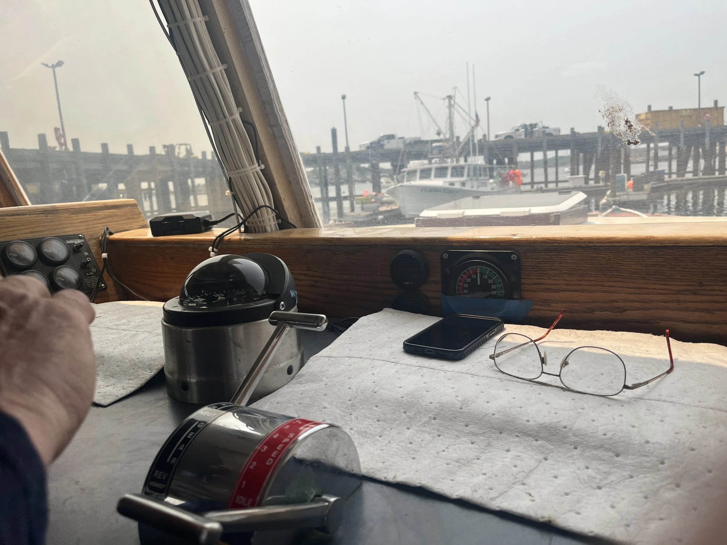
It’s bright and early and I’m standing on the dock in Gloucester, Massachusetts again.
Captain Tom Hill gives me a safety orientation… just in case we become a shipwreck….while looking for shipwrecks.
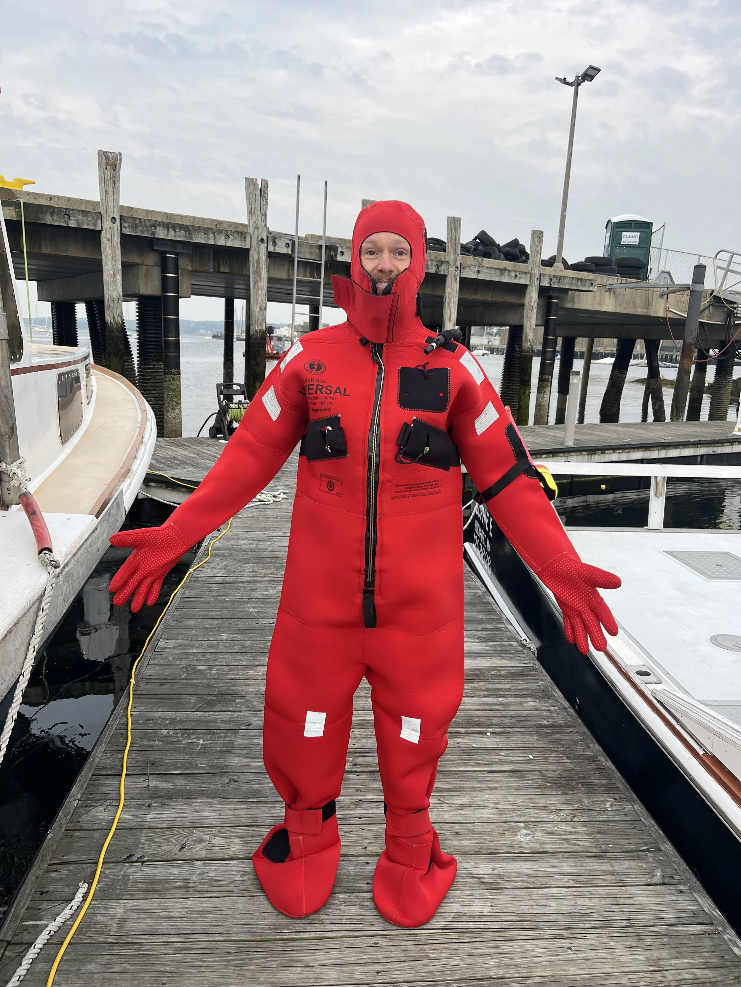
Tom Hill: So if this boat ever went down, you ended up in the water, you'd die of hypothermia really fast.
Felix Poon: He has Mike show me how to put on an immersion suit. Then he shows me the life raft, and the life ring. And then, he shows me the buckets.
Tom Hill: If you're feeling a little woozy…you can puke right in that bucket there. Or if you're more comfortable sitting here, you can puke in that bucket right there.
Felix Poon: Okay. You've got two buckets out there basically.
Tom Hill: Do not go over the edge. Do not do this
[makes throwing up sound]
because you'll stand a chance of going overboard. … when this camera hits the water. I have to look at that plotter because I have to tow those lines back and forth. So I can't pay attention to anything that goes on back here.
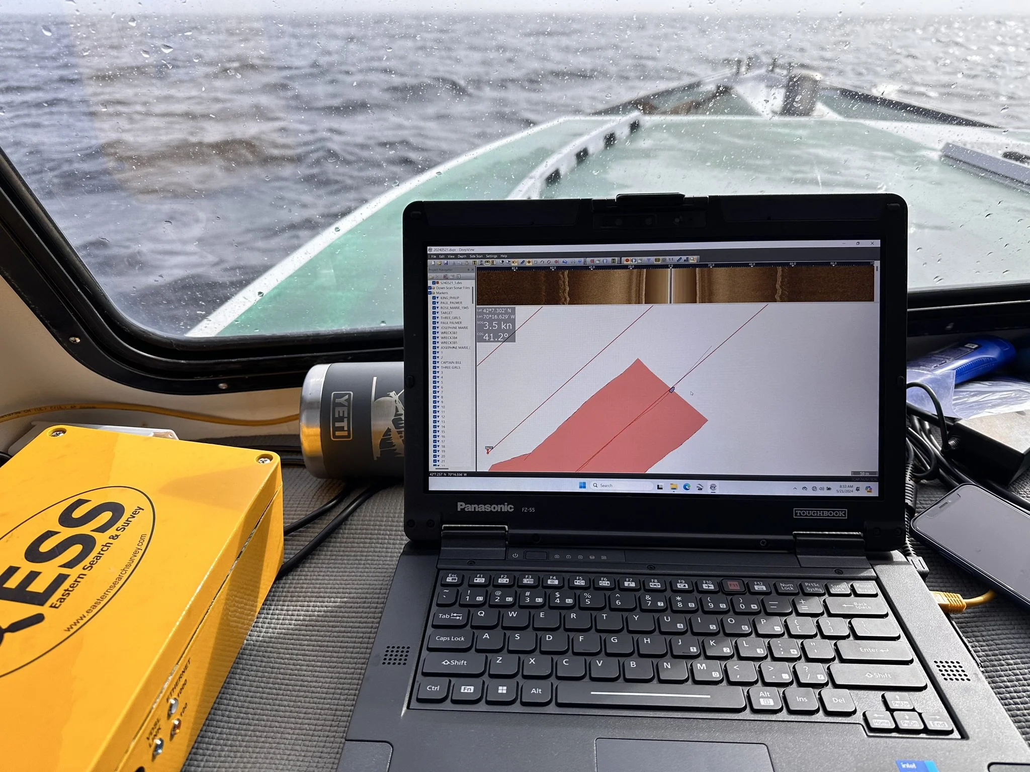
Felix Poon: After my safety orientation is over I go inside what’s called the pilot house and see sonar engineer Ben Roberts on his laptop.
Felix Poon: So did you all find anything interesting over the weekend?
Ben Roberts: Well, we found what appears to be a wreck site yesterday. So pretty excited about that.
And then one is an anomaly. Could easily be a wreck. Um, it's it's unclear. It's unlike anything I've ever seen. It's fairly long. It's about 80ft long. Uh, definitely appears to be man made. It's got some hard angles to it. Um, again, it's unlike any shipwreck I've ever seen. If it is a shipwreck. Um, so it's one that we definitely have to get the ROV on to take a closer look.
[Boat engine revving noises]
Felix Poon: I’m hoping we get to see something like that today.
Felix Poon: Sweet. This is exciting. Yeah. And this map is live updating. That's our boat moving through Gloucester Harbor.
Ben Roberts: That's right. Yep.
Felix Poon: It's a beautiful day to be on the waters.
Ben Roberts: It is. Well, it's beautiful in here. We'll see how it is outside the harbor entrance.
Felix Poon: All right.
[00:47:17-00:47:18] Ben Roberts: Knock on wood.
[Knocks on wood]
Felix Poon: I go from Ben on his laptop, to Tom at the helm. I’m like a kid pointing at things and being like, “what’s that? What’s that?”
Like this card I see Tom has taped to the side window. What’s that?
Tom Hill: That's, uh, patron saint of the fishermen. Saint Peter is the patron saint of the fishermen.
Felix Poon: Do you feel like it? It's like a good luck to have it here?
Tom Hill: I don't think it, you know. You don't ever want to rely on luck in the world.
Just control what you can control and make smart decisions. Don't ever go out in a gale of wind. And don't ever let your ego get you killed.
[MUX IN: Marshes of Harmony - Cora Zea]
Felix Poon: Tom might not want to rely on luck. But I might need it. We’ve left the harbor and we’re on open seas now, and the water has gotten choppier. The motion sickness patch I put behind my ear before getting on the boat? Doesn’t seem to be working. I pop a dramamine, and hope the water doesn’t get any rougher.
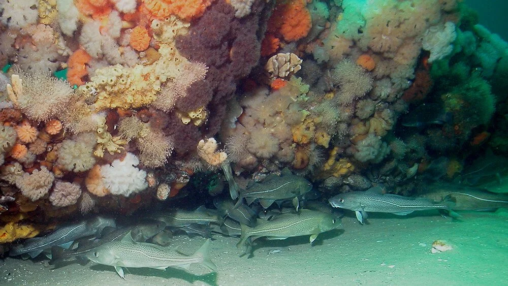
So, the interesting thing about a ship wreck, at least from a marine biology standpoint, is that they become an artificial reef on the sea floor.
That’s because shipwrecks mimic rocks: they provide a hard surface that coral needs to grab onto and grow. They give fish a place to hide from predators. And they’re even a bit warmer because they’re teeming with life.
Like, take a look at pictures of the North Star ship wreck, before it was destroyed by scallop trawlers, and you’ll see it’s covered with big star fish, sea anemones, and all sorts of other weird sea creatures.
And then there’s the fish.
Tom Hill: The wrecks always seem to hold a pile of fish.
Tom Hill: Basically if you're going to go wreck fishing, the most important thing you want to do is figure out which way the tide is going.
Felix Poon: Tom can get into it when it comes to “wreck fishing.” But all we need to know is that it takes real skill, not just for the promise of a big haul of fish, but to do it safely.
[MUX IN: Dialtone 11 - Blue Dot Sessions]
If you get your gear caught on the wreck, that’s a dangerous situation.
Tom Hill: You can't get your net into the wreck, or else you're going to lose the whole kit and caboodle.
Felix Poon: Mike explained what that could look like.
Mike Bailey: ‘cause they went from going three knots to zero. Suddenly everybody just gets this sudden shock and jolt, and they're trying to look around and figure out what happened. And then, you know, within moments…. the vessel is taking on water and starting to sink. Um, so we want to make sure that doesn't happen.
Felix Poon: Short of that, it’s also just expensive to replace fishing gear. Plus, when nets and traps get stuck on the bottom of the ocean, they’re called derelict gear or “ghost gear,” because they don’t stop catching things. Fish and lobster keep getting stuck in them. Even seals. It’s not good for wildlife. And it’s not good for fishermen either.
[MUX SWELL]
This is where the Shipwreck Avoidance Program comes in. The program was started by Ben Haskell. Remember the guy who was dismayed to find out the North Star ship wreck was destroyed by those scallop trawlers?
As part of the program, the marine sanctuary made the coordinates of ship wreck locations public for the first time.
[MUX SWELL AND OUT]
And then they got even more proactive, with something called geo-fencing.
Where they define these circular areas around ship wreck sites, and if a boat crosses into that area, it triggers a warning that pops up on the ship’s monitoring system that reads:
“Captain, your vessel has entered a shipwreck avoidance area … NOAA requests that you keep your gear at least 400 feet away.”
Felix Poon: It’s hard to tell if the program is working or not. There don’t appear to be any obvious incentives for fishermen to heed these warnings. There are no penalties if they ignore them. And many want to fish at ship wreck sites because there’s more fish to catch there.
[MUX IN: McCarthy - Blue Dot Sessions]
Project Manager Mike Bailey says they’re just trying to give fishermen more information. That way maybe they’ll be more cautious in an area where there’s a confirmed shipwreck.
Mike Bailey: Not every fisherman knows what's a shipwreck and what's just a rock.
And our intention is to educate them and say… Just be respectful around them. Like this is not an area to be doing some bottom like towing activity like, you know, steer clear etc..
Felix Poon: And he argues that being unsure if geofencing is working or not is precisely the reason to gather more data on it.
If they can visit these sites every year then they’ll see with their own eyes, or sonar eyes to be precise, if the geo-fenced ship wrecks have fared any better than the non-geo-fenced ones.
But doing this takes money. Right now, the mapping initiative is funded by a one time congressional ear-mark. And Mike says they’re gonna run out of nearly all of this money by the end of this year.
Mike wants to look for new funding, but things aren’t looking good. The Trump administration has already proposed cutting more than a quarter of NOAA’s budget for the next fiscal year.
If congress follows through on that, it’s not just the mapping initiative that could come to an end. The Shipwreck Avoidance Program could be on the chopping block, too. And the fate of the North Star wreck, the one that scallop trawlers tore to pieces? That could be the fate for a lot more wrecks out there, for all these time capsules on the bottom of the ocean.
[TRANSITION]
[AMBI ON BOAT FADE IN]
Mike Bailey: So how's it look?
Ben Roberts: I can't really tell. So I just did four lanes at 50 meter range, Nothing really jumped out at me.
Mike Bailey: Really?
Ben Roberts: Yeah. I did see, you know, a lost lobster trawl. Um, looks like it might be caught in something. Maybe. But, uh, I didn't see, like, real obvious signs of wreckage.
Felix Poon: Tom is taking our boat over a half square mile patch of the ocean. They call this part “mowing the lawn,” which is exactly what it sounds like, except we’re dragging the tow fish behind us, that thing that looks like two torpedoes connected together.
The tow fish uses a kind of echo-location. It bounces sound off the bottom of the ocean and measures its echo. Then it feeds data to Ben’s laptop in the form of a grainy brown image. If there was a ship wreck you might see a shadowy figure in the shape of a boat.
But today, it’s mostly flat. Nothing but mud and sand and a few rocks.
[long ambi of quietly mowing the lawn]
And… that’s how it is for the rest of the day. No ship wrecks.
All in all, it was a pretty uneventful day.
Except for one particular incident.
[heavy breathing, first part of gagging sound then cut out]
Felix Poon: Let’s spare you the sound of me throwing up…
…twice.
You’re welcome.
[MUX IN: Stanza in Fuschsia - Blue Dot Sessions]
They didn’t leave Gloucester empty handed though. After nine days of mapping, they found three new shipwrecks. And then later, working with a different fisherman off the coast of Scituate, Massachusetts, they found another three new sites.
That brings the total since they started mapping last year to 11 new ship wrecks.
A couple of them are historic, including one that looks like a wooden schooner from the late 1800s.
But none are as captivating as The Portland. And If I’m being really, honest, a lot of the wrecks they’re finding are kind of… boring – relatively small modern fiberglass fishing boats
Mike Bailey pushes back on this though. He says it depends on your vantage point in time.
Mike Bailey: We're working, you know, hard every day now to preserve stuff that future generations will hopefully be able to, to benefit from, so that our children and grandchildren will be able to see the same, um, magic and wonder and amazement.
Felix Poon: So, they might sound boring to us today. But, Mike says 50 or a 100 years from now, these modern shipwrecks won’t be modern anymore. Someday, they’ll be an interesting time capsule… of how we once lived…in the early 21st century.
[MUX SWELL AND OUT]
Felix Poon: At the end of the day, I didn’t get to see a ship wreck as storied as the Portland, or as pretty as the North Star. But I did get to see what it looks like when the federal government, archaeologists, and fishermen work together.
And the fishermen themselves are intended to benefit from programs like this. It’s a tough industry to make a living in, and climate change and warming waters are making it even harder. Fishermen can get some extra income participating in NOAA projects like this one. Not to mention these programs are meant to protect fishermen’s safety too.
In return, the fishermen take researchers like Ben and Mike out to sea, and share their knowledge of the ocean with them.
Mike Bailey: That was a pretty critical aspect of this, was working with the fishing community and gaining their trust and confidence in us. It's the fishermen that truly have that wealth of knowledge. Those generations of of data…
Felix Poon: Because this isn’t just about the ships at the bottom of the ocean. It’s also about the ships docked on the pier, and supporting the community of fishermen piloting those boats.
[AMBI ON THE DOCK FADE IN]
Felix Poon: Oh, hey Tom!
Tom Hill: Yeah?
Felix Poon: Thanks for steering us out there. Keeping us safe.
Tom Hill: Yeah, no problem, Felix. Glad you made it back alive.
Felix Poon: I’m glad too.
[MUX IN: Treasure Hunt - Helmut Schenker]
Nate Hegyi: That’s all for today’s episode. If you’d like to learn more about Stellwagen Bank National Marine Sanctuary… from its profiles of known ship wreck sites… to its research into sea birds and whale bioacoustics, check out our show notes for links.
Felix Poon: And for pictures from my reporting trip, head over to our website, outsideinradio.org. We’re also on social media on Instagram, Tik Tok, Bluesky, and X. We’re @outsideinradio.
<<CREDITS>>
Nate Hegyi: This episode was reported, produced, and mixed by Felix Poon.
It was edited by Katie Colaneri, and Taylor Quimby. I’m your host, Nate Hegyi.
Taylor Quimby is our executive producer. Rebecca Lavoie is NHPR’s Director of On-Demand Audio.
Our staff also includes Justine Paradis, Marina Henke, and Jessica Hunt.
Felix Poon: Special thanks to marine biologist Kirstin Meyer-Kaiser (MAI-er-KAI-zer) for educating me on the marine biology of shipwrecks, and to Samantha Tolken and Laura Howes with the Stellwagen Bank National Marine Sanctuary.
Nate Hegyi: Music in this episode was by Blue Dot Sessions, Walt Adams, Cora Zea, and Helmut Schenker.
Outside/In is a production of New Hampshire Public Radio.